Pinchot Pass was another easy pass, just a very long approach and sustained climb. During midday we took a detour to avoid a double crossing of dangerous river. Setting up camp around the early afternoon we planned to tackle Mather Pass tomorrow morning. I was a little nervous about Mather due to comments from other hikers mentioning avalanches and tough technical rock scrambles. Also Clax had warned us at Casa De Luna that Mather was the toughest pass last year on the PCT. I slept uneasy with night terrors of falling down the face of the mountain.
As we approached Mather at dawn it seemed very reminiscent of Forester Pass. Taking advice from some hikers camped near the base of the mountains, we decided to take a path along the left face despite the PCT going on the right. First there was a vertical climb on snow which had me using steps cut into the ice wall. Despite the verticality, it was quite easy with the ice axe handy. After climbing straight up we came to an exposed rock section which we traversed without any trouble. This was followed with another vertical snow scramble then a few exposed actual switchbacks. Finally it topped out with a shallow snow ascent to the top. All in all I never once felt scared and actually preferred the technical climb versus the boring and long climbs of Glen and Pinchot.

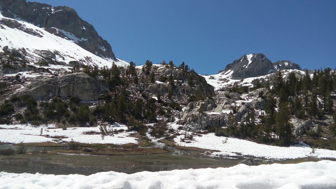
From the top of the pass we dropped in a gorgeous forest valley and trekked on to complete a 20+ mile(32 km) day. We camped very early again and were set up up for Muir Pass tomorrow.
I woke up grumpy having spent the night on a rocky patch. My pad was completely useless and deflating every twenty minutes. Getting my mind focused we took off to conquer Muir Pass. This is by far the longest approach of all the passes with uncountable sun cups slowing our progress. At one point I get confused at which way to go and end up having to make a vertical rock descent detour to rejoin the main boot pack. After trudging for hours we finally reach the top of Muir which has a nice little stone hut to hide away in.

The descent from Muir involved 7+ miles(11 km) of snow until we finally escaped. The stonework of the trail down into a lush valley was astonishing. Definitely the nicest section of trail so far. The other big challenge for the day was Evolution Creek. This creek has claimed lives in the past but there was an alternate that could be taken to avoid the real danger. The alternate was in a boggy marsh but otherwise easy to cross.
The rest of our afternoon was spent below the snow line surrounded by trees and other vegetation. We completed a total of 27 miles(43.5 km) to camp and prep for Selden Pass tomorrow.
With Mather Pass behind us there were no other passes to really worry about. Selden Pass was summited easily and in the early morning, only needing micro-spikes near the very top. We made excellent progress to reach the real hazard of the day, Bear Creek.

Another deadly river, this one had no alternate so the three of us had to figure out a good crossing. Even reaching the river before 1000h it was raging and deep. I found a section where a completely submerged log almost connected out to another semi-submerged log to form a sort of bridge. I made the attempt and was quickly caught out. Half way through I became entangled in sharp branches and vegetation. I kept moving forward again having to make a lunge to get to the second tree and holding on to strained, wet branches. My feet and legs went numb as I yanked myself with my arms across the second tree and onto the other bank of the river. The water had reached my chest and my pack was quite wet as well. With no feeling in my feet I had no time to recover from the crossing but instead began pacing around to keep blood flowing.
Oliver and The Kid learned from my mistakes and didn't cross at the same spot. Instead they went back upstream and used a two-person crossing technique to cross in an elegant fashion. The rest of the morning had me following them very far behind shivering, walking on the concrete blocks that were my feet. Thankfully the sun rose an hour later and I was promptly revived, also able to dry out all my gear very quickly.
There was another big river to cross that day, Mono Creek, but thankfully it was a simple matter of finding the log crossing which kept us high and dry. The rest of the day from that point unfolded uneventfully as we hiked forward to a camp spot that was close to Silver Pass.
Silver Pass was another easy summit with a slightly interesting descent littered with glissades. The day had no major river crossing. We did have to cross a frozen lake and one section of deep but calm snow-melt water. Other than being freezing cold it wasn't really an issue. The snow did follow us all day though even well below 9000ft(2743 m). Camping in the evening we were ready to reach Red's Meadow for resupply tomorrow.

Reaching Red's Meadow before 0800h was not an issue but there were other complications. There is no good resupply at the resort so we wanted to go to Mammoth Lakes. A shuttle is supposed to run...but we arrived a day before it would be operational for the year. We went around the resort begging for a hitch.
In a stroke of luck, a civilian managed to sneak by the road blockade and offered to give us a hitch out as well. In Mammoth Lakes I am introduced to Grocery Outlet. The prices are really cheap and things are mostly sold in bulk which really worked well for us hikers. I bought a ton of food, aiming at around 4000+ calories per day.
The Kid really wanted to do laundry so Oliver and I decide to stick around to wait for him. My main priority was throwing away my inflatable sleeping pad and buying a new one, which ended up being the Nemo Switchback Short. Walking around to kill time I was surprised to come across Ari. She seemed to have been doing better and we chatted very briefly before I went off to eat lunch. I devoured a 12" pizza in less than seven minutes and was left with a bad stomachache.
Allowing myself to digest, about two hours later The Kid, Oliver, and I finally wrapped up our town stay. We started our way back to trail but this time we weren't so lucky on the hitch. We ended up walking about half of the way back to Red's Meadow. Thankfully a forest service worker gave us a ride in his van for the last bit. From there we walked 3 miles(4.8 km) to camp for the night.

Without much planning we tackled both Island Pass and Donohue Pass during the middle of the day. This time we didn't use micro-spikes as the snow was too soft. Donohue in particular was mentally difficult with the sun beating down relentlessly over miles of sun cupped snowy climbing. The saving grace was the near straight and continuous glissades down the back. It felt like I was skiing as I slid further and further down the mountain.
There were a handful of river crossing that we were lucky enough to have either snow bridges or log bridges to cross over with. We camped in the evening 10 miles(16 km) away from the next stop, Tuolumne Meadows.
Upon arrival in the morning we discover that Tuolumne Meadows is still not open for the season. We meet a French hiker named Brightside and we try to hitch east together. After about twenty minutes, a dude with a huge husky decides to take us. Oliver, The Kid and I get dropped off at a gas station while Brightside continues on with the hitch to Bridgeport.

We all stock up on food but the selection is very limited and expensive. While we wait I order and eat a large breakfast burrito plus a burger with fries. Hitching back out, a girl takes us back up and we chat about the John Muir Trail.
Once back on trail we continue onwards fairly quickly all day. There are a few rivers fords in the evening but they present no real danger. After a total of 25 miles(40.2 km) we settle in to camp.
Throughout the day the terrain becomes steep and the trail leads us over many climbs. At the top of a pass there is a seemingly abandoned pack. I recognize it as Ari's and call out. She appears from behind some rocks on the phone and joins us.
After a snowy and slick descent the trail tries to take us alongside a raging river. Due to the path being buried, we are forced to walk on a precariously slanted section of slippery snow. A misstep or slip would have us sliding about 10ft(3 m) and into the river. We all go slowly and deliberately to safely get over this section.
There is one difficult river crossing before the day ends. It's extremely deep so Oliver goes to scout a good crossing point. He comes back soaked, having accidentally fallen in, but not empty handed. We take a large detour through swampy and shallow water, over a log and finally a short wade through a marsh to get across.
We camp right on the bank of the river. There is a deer nearby that does not scare away and decides to poke its nose around. It hangs around and gets very close to Ari throughout the night.